 EMODnet Product Catalogue
0.001953 Arc minute
Type of resources
Available actions
Topics
Keywords
Contact for the resource
Provided by
Years
Formats
Representation types
Scale 1:
Resolution
-
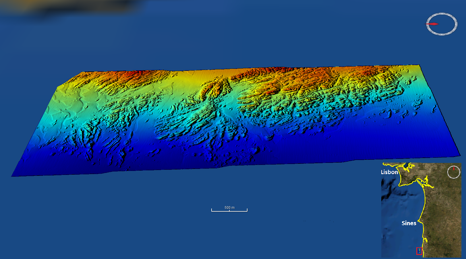
High resolution (1/512 minute ~ 3.6m) bathymetry dataset from the Mineplat 4 cruise onboard IPMA RV Noruega. Portugal southern continental shelf, off Alentejo coast, 24 March to 4 April 2019. Depths between 60 and 110m. Seabed sediments sampling was performed during daytime and multibeam mapping during the night, with a Reson T50-P multibeam echosounder. Depths are referenced to the Portuguese Chart Datum (2m below MSL) and WGS84 horizontal reference frame. Position and attitude data (GNSS+Inertial via Applanix OceanMaster POSMV) was post-processed with POSPAC.
-
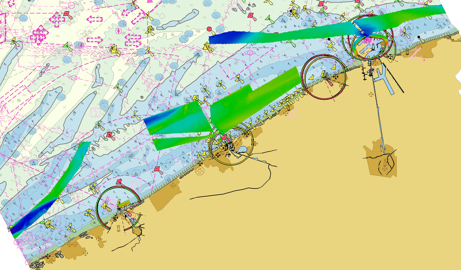
Source data for the EMODNet DTM for the Belgium Coastal Waters is compiled by the Vlaamse Hydrografie (http://www.afdelingkust.be/en/bathymetric-database) at a resolution of 1/512 arc minute. The data set covers the waters along the Belgian coast.
-
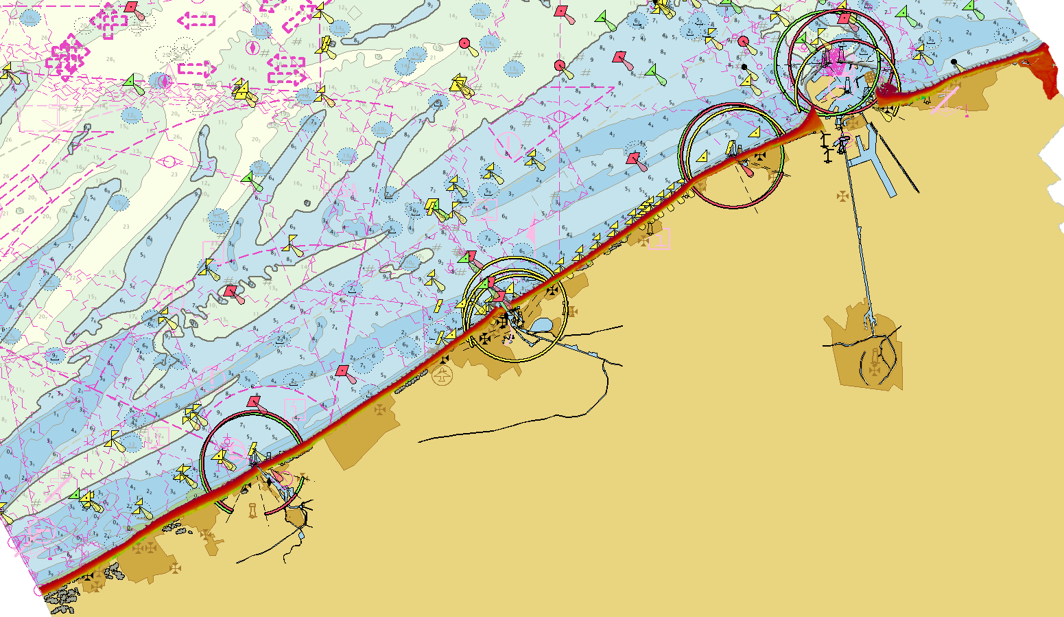
Source data for the EMODNet DTM for the Belgium Coastal Waters is compiled by the Vlaamse Hydrografie (http://www.afdelingkust.be/en/bathymetric-database) at a resolution of 1/512 arc minute. The data set covers dry coast and dunes along the Belgian coast.